Modern Techniques and Tools for Wilderness
Navigation
By Jack Shaw
Navigating the wilderness may be more than just a hobby for you. Perhaps it helps you keep sane and relieve stress. Thankfully, you no longer have to rely on outdated maps and unconventional methods to find your way. Technology has made navigating even the deepest forests and most remote locations easier and safer. Here is some of the best tech-based navigation gear you can use in your next adventure.
1. Global Positioning System (GPS) Technology
GPS is popular with hikers, campers and hunters when navigating the wilderness. Many Americans are outdoor fanatics, so even beginners venture into the wild with a GPS unit. Its biggest draw is it doesn’t require an internet connection or phone signal to function. Here are the top reasons why you should get a GPS tracker:
- Accurate navigation: Modern GPS tracking systems are incredibly reliable and offer 99.88% accuracy. They can calculate your location by determining your position from at least three satellites.
- Enhanced safety: GPS provides real-time data. It has emergency alert capabilities for those who get lost, allowing you to send a signal to rescuers.
- Upgraded performance: GPS has essential vital metrics, like elevation, distance and speed, enabling you to navigate unfamiliar terrain safely.

Photo Credit: Unsplash
How GPS Works
GPS requires three fundamental elements — satellite, ground receiving station and the receiver on the tracker. It’s a system of 31 satellites serving as site markers to determine precise positions in the wild.
The satellites serve as landmarks. The GPS tracker receives signals from the satellites containing coordinates on how far or near you are to at least three of them. The tracker uses “trilateration” to calculate location, velocity and other movement data. The information is then passed onto a central server, fitted in your GPS tracker, allowing you to see your precise location on the screen.
How To Use GPS
GPS models offer various features, screen sizes and menus. If you’re a beginner, choose a brand that’s easy to use.
If you’re ready for an adventure, download your route to a handset. Use a computer to plan your destination and waypoints. Then, connect the tracker to the PC via a USB cord so you can transfer the route data to the GPS. Ensure you’re outdoors when navigating for the satellite signals to reach your device and provide you with precise positioning data.
A GPS unit is a valuable tracking tool for outdoor fans, but you can’t singlehandedly rely on it. For instance, it can’t tell you whether a trail is prone to hazards or is closed.

Photo Credit: Bernie Friel
2. Smartphone Apps
Smartphones can do so much more than call and message people. The latest versions are equipped with various location apps, making them helpful in navigating.
Online and Offline Maps
Your smartphone can double as a GPS when using its built-in or downloadable map apps. Apple and Google Maps are reliable sources of location data. Fortunately, you can use both with or without an internet network. If you want more reliable options, download paid third-party offline maps and use them like a GPS tracker in plotting your routes and stops. Some great examples are:
- Gaia GPS
- ViewRanger Skyline
- Backcountry Navigator
- MotionX GPS
- AllTrails
Some offline maps are free, but you rarely find one with reliable, detailed trail information. Investing in paid options is worth it if you get access to correct data.
Download the map on your phone to use it internet-free. Then, save your routes or add points of interest markers before you set off on a hike. These apps also have sharing features to send your locations to loved ones. Switch to offline map viewing if you reach a point with zero service.
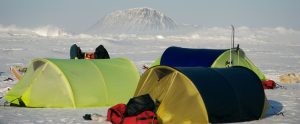
Photo Credit: Will Steger
Compass
An alternative for maps is a mobile compass, which is built-in on most phone models. You can also try external apps. Some of the best ones include:
- Commander Compass
- Compass Galaxy
- Compass 360 Pro
- Commander Compass Go
- Compass 54 Lite
- Compass Heading-Magnetic Digital Direction Finder
These apps are free, but some may require a fee for extra features. Here are some excellent reasons to use a compass:
- It determines cardinal directions so you can maintain the right orientation. It will point you exactly to the north if you’re heading in that direction.
- It increases the accuracy of navigation. You can use it with a map to confirm you’re reading the directions right.
- It provides help during emergency navigation. In case the offline maps fail, it can be a backup navigational tool to find your way.
Altimeter
Another location tool to take advantage of is an altimeter. Radar and laser altimeters are widely used in planes and spacecraft to measure elevation. Use the app version to gauge your altitude when hiking. It can detect the following:
- Elevation: You get real-time information on your vertical position relative to the landmarks on the maps.
- Terrain features: An altimeter can distinguish terrain features like valleys, ridges and peaks by the changes in altitude.
- Weather shifts: Barometric altimeters can spot the shifts in air pressure when there’s an impending weather change that can put you at risk — like a storm or rain — so you can avoid them.
Some apps you can try are:
- Accurate Altimeter
- Altitude App
- Altimeter by PixelProse SARL
- Travel Altimeter & Elevation 4+
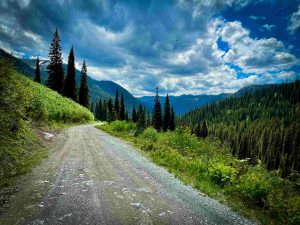
Photo Credit: Marie Soleil-Blais
Importance of Complementary Navigation Tools
The map, compass and altimeter are reliable tools, but technology can fail you if your phone runs out of battery or gets broken after dropping it. You don’t want to get stuck in the mountains unless you intend to camp, so always bring a second or third traditional navigation tool. In addition, ensure you know how to read a map and compass. It’s one of the hiking skills to have.
Backup gear provides another layer of safety and security in emergencies. Plus, they’re cheap and lightweight, so carrying them won’t make your backpack too heavy.
Leverage Technology for Safer Navigation
Technology makes wilderness navigation less risky yet more accessible. Use it to keep you on the right track and enjoy your time on the trails.
Author Bio
Jack Shaw is the senior writer for Modded, a men’s lifestyle publication. An avid outdoorsman, he’ll often find himself taking retreats out into nature to explore his environment and encourages others to do the same. His writings have been published by Duluth Pack, Trekaroo, Lehman’s and more.

Recent Comments